Contact Us
-
Bhagwan Bahal Marga,
Thamel, Kathmandu - +977-9701525176
- trekhimaltour@gmail.com
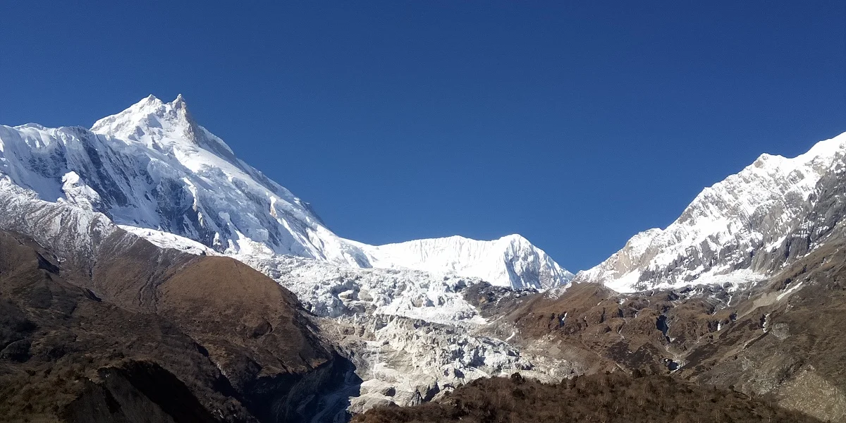
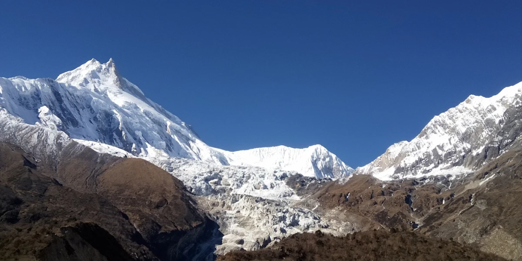
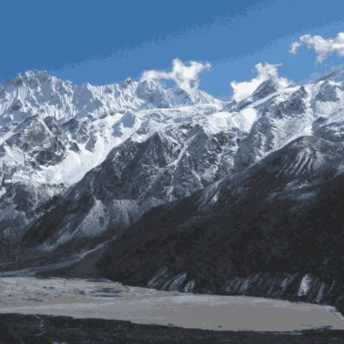
The Manaslu Circuit Trek is a laborious trek that demands experience and good physical well-being. The Manaslu trek ascends through the Budi Gandaki River, offering numerous rivers and waterfalls to Larkya La Pass (5106 m), the highest point in the Manaslu Trek, providing striking views of Himalchuli, Manaslu (8156 m), Ganesh Himal, and various other mountains.
En route, diverse landscapes and a variety of flora and fauna amaze anyone. The laborious part of trekking along the Manaslu circuit starts from Samagoan (3450 m), where you could get lucky and see the freezing green lake of Birendra.
However, the biggest challenge awaits—crossing the snow-clad Larkye La pass (5106 m), which is 8 km from the Tibet border and offers classic views of Himlung Himal (7,126 m), Cheo Himal, Gyaji Kang, Kang Guru (6,981 m), and Annapurna II (7,937 m). From Larkya La (Larkya Pass), we take a steep descent along a snow-covered trail down to Tanbuche.
Then we follow a narrow trail to the Dudh Khola (Milk River) banks, passing through magnificent forests of rhododendron, pine, and juniper. A further descent transforms the alpine vegetation to subtropical greenness. Then the walk through the Marshyangdi River to Besishahar marks the end of the trek.
14 Days Manaslu Trek is getting more and more popular as a new trekking destination, but it still sees fewer trekkers compared to the established trekking routes in the Annapurna region. The Manaslu Trek is a stunning trek with spectacular views of Mount Manaslu (8163 m) and the Ganesh Himal Range, among others.
Along the trail to the Manaslu Trek, you will cross an interesting mix of authentic Hindu and Tibetan-style Buddhist villages. The trail follows the spectacular Budhi Gandaki River from Arughat to its source just below the Larkya Pass (5106 m). As you start low, at around 700 m, the landscapes are incredibly varied, ranging from the green countryside and lush forests to spectacular high-altitude landscapes skirting huge glaciers.
Crossing Larke Pass (5125 m) can be tough when there is snow. However, the stunning landscape with the mighty Himalayas towering straight above you and the spectacular glaciers make it more than worth the effort. The Larke Pass links the Budhi Gandaki with the Marsyangdi Valley. The descent passes through beautiful alpine meadows at Bhimtang before joining the main Annapurna Circuit route heading to the trailhead at Besisahar.
The Manaslu Circuit Trek is easily accessible from Kathmandu. It originally started in the town of Arughat or Sotikhola or Machhi Khola; however, with roads being built, many trekkers start at either Barpak or Machhi Khola, a bit further up the trail.
The Manaslu Trek described here starts in Soti Khola and ends in Dharapani. It’s also possible to finish the walk in Besisahar, which is also the starting point for the Annapurna Circuit Trek. The itinerary below is one of the many possibilities. The trek can be made longer or shorter depending on the length of your walking days and starting point.
There are basic guesthouses all along the trail, so you can choose to camp or stay at the teahouses. You can combine the Manaslu Circuit Trek with the Tsum Valley, a beautiful, secluded valley where century-old Tibetan traditions prevail.
We at Green Valley Nepal Treks and Research Hub have crafted a 14-day Manaslu Circuit Trek itinerary that includes your arrival and departure days to and from Nepal. We love to share our knowledge and stories of the region, and we are prepared to go the extra mile to provide our clients with an exceptional and personal adventure in this magical region of Nepal.
At Kathmandu airport's arrival terminal, a representative from Green Valley Nepal will be waiting for you. The agent will greet you and take you to your Kathmandu hotel. You can either take a rest or meet us at our office and know the details about the Manaslu Circuit Trek itinerary.
The hike leader/guide will meet you at the hotel after breakfast. The purpose of this pre-trip meeting is to provide a Manaslu Circuit Trek overview and other important information. Please bring a copy of your travel insurance policy as well as your passport and three passport-sized photos. You may utilize your free time to relax or go shopping for last-minute items.
You will board a public bus to Machha Khola after breakfast in Kathmandu, passing through Arughat and Soti Khola to officially begin your Manaslu Circuit Trekking Itinerary. It will be a lengthy journey, with the first part of the journey being smooth over a blacktop major roadway to Arughat, and the second half of the journey being challenging from Arughat. As you go over the rocky road to Maccha Khola, be ready to bounce your body with some actions. The trip, on the other hand, will provide some spectacular views of Nepal's landscapes.
Journey to Maccha Khola from Kathmandu
Along the Budhi Gandaki River, you will continue on the trek. The Manaslu Circuit Trek route travels through Khorlabesi, ascending and descending at small altitudes, until arriving at Tatopani, a hot spring. You will be amazed by the breathtaking scenery at Doban, Thulo Dunga, and Yaru Bagar as you traverse a mountain and cross the Budhi Gandaki River.
The path twists and turns across the river, passing across multiple suspension bridges until arriving at the Manaslu Conservation Area's entrance gate, where you will register your permits at a police checkpoint in Jagat. To go to Jagat, you will have to ascend up in height, which will affect your perspective and vegetation. Langur Monkeys may appear unexpectedly during your jungle walk.
Journey from Maccha Khola to Jagat
The trek starts over a stony ridge, with a glimpse of Sringi Himal in the distance. You will voyage via Salleri, Sirdibas, and Ghatta Khola before arriving at Philim, a Gurung settlement. Then, via Ekle Bhatti, your Manaslu Circuit Trek Route will go to Nyak village, crossing the Budhi Gandaki River twice over suspension bridges.
After traveling through a desolate canyon and following the Budhi Gandaki's bank pathways, you will arrive in Deng village through Pewa Khola and bamboo forests.
Journey from Jagat to Deng
Manaslu Circuit Trek will begin in Deng and proceed up to Rana and Bihi Phedi, passing a suspension bridge across the Budhi Gandaki River. This trek will climb steadily and pass through a variety of woodlands and mani stones before arriving in the lovely hamlet of Ghap.
After that, you will go to Ghapsya, taking in the spectacular vistas of Shringi Himal along the route. The landslide area will begin at Ghapsya, so be careful. You will rise to Namrung by following the river and crossing it many times through the forest and gompas.
Journey from Deng to Namrung
You will hike a difficult trail through a forested region from Namrung to Lihi, with beautiful vistas of mountains such as Saula Himal, Pangkar Himal, Kutang Himal, and Pangbuche Himal. Beautiful chortens and barley fields, as well as a sight of the Manaslu Himal, can be seen from Lihi.
As your Manaslu Circuit Trekking trail progresses, you will notice a shift in the vegetation and meet more Buddhists. You will reach Lho village after going via Sho Village, where you can observe Punggen Glacier.
Journey from Namrung to Lho
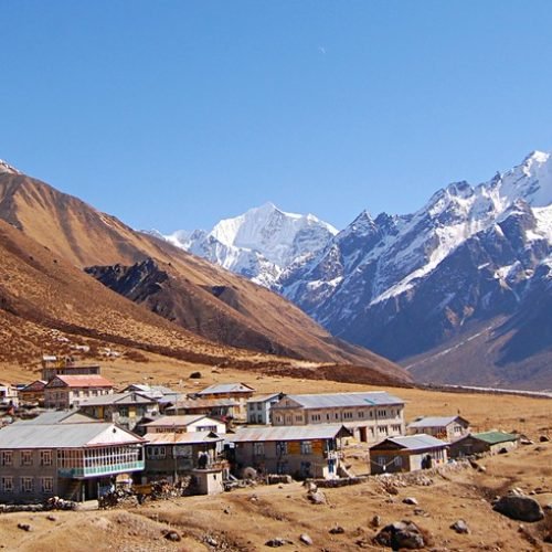
From Lho to Samagaon, it will be a short climb. On the Manaslu Circuit Trek route to Samagaon, you will travel via Shyala village, which has amazing scenery, gompas, Tibetan communities, and alpine beauty. From Samagaon, you will have a close-up glimpse of Mt. Manaslu during this walk. Village entrance gates are widespread, and you may witness village ladies spinning wool into dresses or buying Chinese whiskey on the street.
You could have some free time after your delicious lunch. You might thus take use of that time by taking a quick stroll to Birendra Lake or Pungyen Gompa. The Buddhist temple at Pung Gyan Gompa is surrounded by numerous tall mountains, making it the ideal site to spend some time in. The same goes for Birendra Lake, which is approximately an hour's walk from Samagaon and offers a stunning vista of blue and green colored lake water.
Journey from Lho to Sama Gaun
Note: Depending on trail conditions and hiking pace, these times are estimates that could change accordingly.
We strongly advise spending a day in Samagaon acclimating to the altitude. You can hike close after dropping your luggage off at the teahouse, which aids in acclimatization. The acclimatization days will provide you with several excellent walking choices. First, Birendra Lake is a freshwater lake next to Punhyen Glacier, at a height of 3,450 meters. It's just a 3-kilometer walk from Samogaon to the lake.
The eighth-tallest mountain base camp in the world, Manaslu Base Camp, is accessible via hiking. At 4,800 meters, it is roughly 6 kilometers away from the village. The third is Pungen Monastery, which is 6-7 kilometers away from the settlement.
A monastery, peaks, prayer flags, and mani walls may all be seen from the peaceful and picturesque trek. This is the day to try to visit all three places. You can visit at least two of them if not all of them. Finally, in the evening, the hike will return to Samagoan.
To get to Samdo, you will have to ascend steeply on an isolated trail. Manaslu Circuit Trekking trail will take you along the Budhi Gandaki River and through a lovely woodland with Rhododendron, Juniper, and Birch trees. The valley widens before approaching Kermo Kharka and the white Kani Gateway. The path's attractiveness is enhanced by the mani walls that border it.
As you continue, you will reach Samdo, which is only 4 kilometers from the Tibetan border. Mt. Manaslu, Simnang Himal, Ngadi Chuli, Manaslu glacier, Manaslu icefall, and other Himalayan peaks can all be seen from here, as well as a Tibetan refugee community.
Journey from Samagaon to Samdo
Note: Depending on trail conditions and hiking pace, these times are estimates that could change accordingly.
The hike is short today, so you will have plenty of time to get used to the altitude. The Manaslu Circuit Trek continues across hills and over wooden bridges across the Budi Gandaki. The Larkya glacier will be reached after crossing two streams, followed by a stunning valley. The views of Manaslu and the Syacha Glacier are spectacular on this trail.
On the way to Dharamshala, if you are lucky, you could see Himalayan blue sheep. Peaks like Jarkya Himal, Nysing Himal, and Lajyung Himal, as well as glaciers like Fukang Glaciers, Larkya Glacier, Syacha Glacier, Yamnang Glacier, and Manaslu Glacier, can all be seen from Dharamshala.
Journey from Samdo to Larkya Phedi (Dharamshala)
Note: Depending on trail conditions and hiking pace, these times are estimates that could change accordingly.
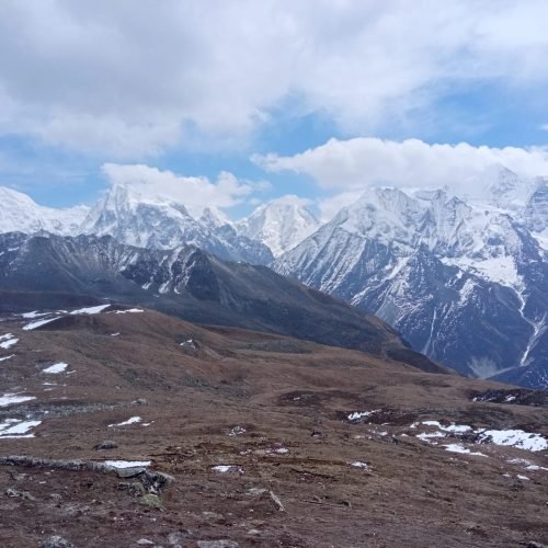
The most anticipated day of the Manaslu Circuit Trek is when you will pass Larkya La Pass (5160m), the trek's highest point. Cho Chanda will be climbed first, followed by a gradual ascent to the high snow-covered pass. From the summit, the panoramic views of the mountains are simply breathtaking.
The Himlung, Cheo, Gyagi Kung, Kang Koru, and Annapurna II are just a few of the snow-capped Himalayas you will see. After that, it's a hard drop across moraines to Bhimphedi. From Bhimphedi, visitors may see glaciers like Dobhan, Purdi, and Ponkar, as well as small lakes like Ponkar and Nayamlo.
Journey from Larkya Phedi to Bimthang
Note: Depending on trail conditions and hiking pace, these times are estimates that could change accordingly.
This is the last day of trekking in the Manaslu region as you can see in the Manaslu Circuit Trek Itinerary. The descent from Bimthang passes through high-grazing grassland, Dudh Khola, and rhododendron woodland, with views of Manaslu, Lamjung Himal, Himlung Himal, and Cheo Himal. First and foremost, after passing Dobhan and Purdi Khola, you will descend from Bimthang to Hampuk hamlet.
Then, on your way to Gho Village, you will travel through Yak Kharka and Kharche, as well as the magnificent streams Soti Khola and Kasongto Khola. After crossing Gho village following the bank of the river, you will finally arrive at Tiliche.
Journey from Bimthang to Tiliche
Note: Depending on trail conditions and hiking pace, these times are estimates that could change accordingly.
The ideal time frame for this journey is 14 days, starting and ending in Kathmandu. The journey may be completed in 10 or 12 days, but doing so would mean rushing through it and possibly missing out on some of the experience. Not to mention that it will be tougher and more physically exhausting. If you have the time, think about taking an excursion to the magnificent, freshly inaugurated Tsum Valley.
In addition to the Annapurna Conservation Area Permit (ACAP), you also need the Manaslu Special Permit and the Manaslu Conservation Area Permit (MCAP). For your peace of mind, Green Valley Nepal Trek will assist you with all the essential documentation.
To carry 20 kg of baggage for two hikers, Green Valley Nepal will employ one porter (a maximum of 10 kg for each trekker). Don't overwhelm your porters, since they not only carry your gear but also help you achieve new heights in spirit. In addition, their efforts to carry you to your goal may be motivated by your love, devotion, and generosity. So please be mindful of this.
Not all locations on the Manaslu Circuit trip offer ATM services. Therefore, be sure to have adequate cash with you.
After making the advance deposit, please email the following papers to us.
The Manaslu Circuit trek is most enjoyable during the spring months (March to May) and autumn (September to November) because of favorable weather conditions along with clear views.
Experiencing the Manaslu Circuit Trek demands excellent physical condition together with previous trekking skills due to its classification as moderate to challenging.
The Larke Pass located at 5,160 meters stands as the peak elevation point during the Manaslu Circuit Trek.
The necessary equipment for trekking includes a premium sleeping bag together with trekking poles multi-layered clothing first aid supplies and water purification tablets.
The main health threat of this journey is altitude sickness so everyone should take proper acclimation steps alongside constant hydration
The teahouses offer charging services yet travelers must bring a portable power bank for additional convenience.
Trekkers who visit the region might spot blue sheep along with Himalayan tahr and many different bird species besides other wildlife.
Mobile networks have restricted coverage throughout the region while specific teahouses supply Wi-Fi service with emergency satellite phones.
Only works on Trip page.

Ut enim ad minim veniam, quis nostrud exercitation ullamco laboris nisi ut aliquip ex ea commodo consequat. Duis aute irure dolor in reprehenderit in